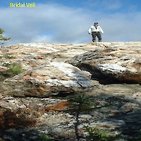
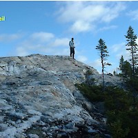
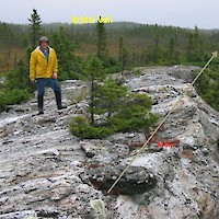
Bridal Veil
Copper-Gold-Silver Project in central Newfoundland
Introduction
Bridal Veil is a copper-gold-silver project that is situated between the Newfound Gold Corp. “Queensway” gold project (15 kilometers to the west) and the Star Track Gold Property near Benton. This region of central Newfoundland has attracted a lot of recent exploration interest for gold targets. CMC can acquire a 100% interest in the property by completing all terms of the option agreement announced on November 3, 2020 (see our News section).
Location and Access
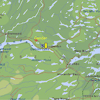
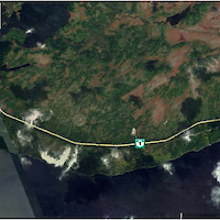
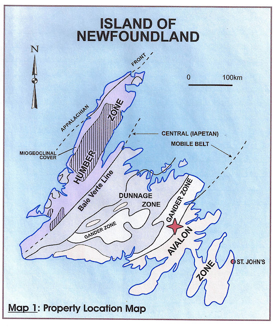
Bridal Veil is located 10 kilometers east of Gander in NTS map sheet 2D/15. The southern part of the property straddles the Trans Canada Highway and other parts of the property are accessible by ATV and other man using the former railroad access bed and trails.
Claims
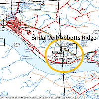
The Bridal Veil property comprises of 126 claims and is approximately 3,150 hectares (see Maps 2 and 3).
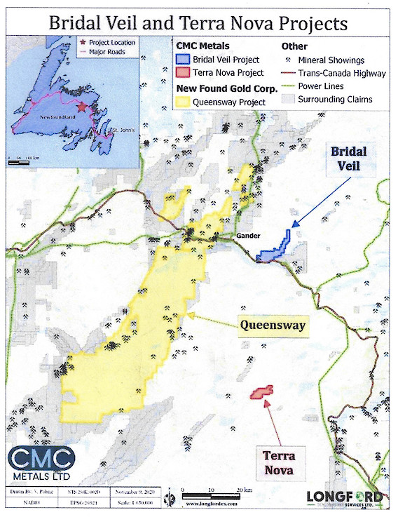
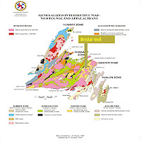
Map 2: Bridal Veil Location in the Gander Zone, central Newfoundland and in close proximity to the Queensway gold project by Newfound Gold Corp.
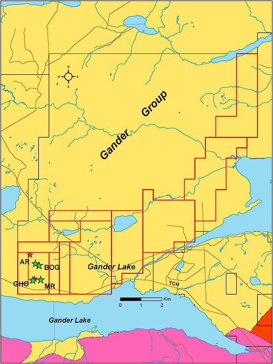
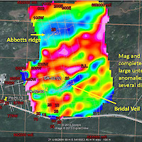
Map 3: Bridal Vein claims (outlined in red).
AR = Abbots Ridge; BOG = Bog; GHO= Hidden Outcrop; MR=Megan’s Rise
Regional Geology
The property lies within the Gander Zone and is underlain by sedimentary rocks of the Gander Group.
Much of the northeast Gander Lake Subzone was last mapped at 1:50,000 scale in the late 1980s and early 1990s (O’Neill, 1987, 1990a, b, c, 1991a, b, 1993; O’Neill and Knight, 1988; O’Neill and ColmanSadd, 1993), broadly coincident with the geophysical work of Miller and Weir (1982) and Miller (1988). Other than sporadic mineral exploration work, little academic or government studies have since been undertaken in the Gander Lake Subzone. A number of undergraduate and graduate dissertations have provided new geochronological and petrochemical constraints on the rocks of the subzone (e.g., see Buchanan and Bennett, 2009; Langille, 2012).
The northeast Gander Lake Subzone (Williams et al., 1988) is underlain mainly by a central area of relatively “flatlying” turbiditic metasedimentary rocks of the Gander Group (e.g., Hanmer, 1981; O’Neill and ColmanSadd, 1993). These units are structurally bound to the west by the northnortheasttrending Gander River Complex (GRC), a relatively narrow belt (≤8 km) of structurally imbricated peridotite, gabbro, basalt, trondhjemite and marine sedimentary rocks collectively considered to represent a dismembered, CambroOrdovician ophiolite complex (O’Neill and Blackwood, 1989; O’Neill, 1990a, b). The GRC is undated, but it is unconformably overlain and imbricated with rocks of the Weirs Pond Formation (O’Neill and Blackwood, 1989; O’Neill, 1991a, b), part of the basal Davidsville Group that contains brachiopod fragments, indicative of a Middle Ordovician age (Jenness, 1963; McKerrow and Cocks, 1977). These are slightly older than, but overlapping in age with limestone of the Weirs Pond Formation near Weirs Pond (Stouge, 1980). Therefore, the ophiolitic rocks are inferred (Blackwood, 1982; ColmanSadd et al., 1992) to have been emplaced eastwards over the Ganderian margin around 475–470 million years ago (Neuman, 1967; Zagorevski et al., 2010; van Staal and Barr, 2012). The ophiolitic GRC is therefore older than ca. 475 Ma.
Regional mapping, geochemical, structural, metamorphic and geochronological studies (O’Neill, 1987; O’Neill and Knight, 1988; O’Neill and Lux, 1989; O’Neill, 1991a; O’Neill and ColmanSadd, 1993) have clarified many issues relating to northeast Gander Lake Subzone geology. O’Neill and Knight (1988) and O’Neill and ColmanSadd (1993) redefined the Gander Group as consisting of two distinct metasedimentary packages:
- the Jonathans Pond Formation (JPF) comprises interbedded arenitic sandstone and semipelite, and;
- the overlying Indian Bay–Big Pond Formation (IBBPF) typically comprises finegrained pelitic metasedimentary rocks, but locally intercalated with pebble to cobble conglomerate, maroon siltstone and basaltic lavas (Wonderly and Neuman, 1984; O’Neill and Knight, 1988; O’Neill and ColmanSadd, 1993).
Local Geology
The geology of the property is dominated by the Jonathan’s pond Formation of the Gander group. This formation is Cambrian to early Ordovician in age (540-480 million years) and comprises of psammite grey-green pelite (clayey sandstones), minor quartzite and quartz-granule sandstones, thin mafic layers, and local felsic and mafic intrusions. These rocks have been subjected to multiple phases of deformation and lower greenschist grade metamorphism. The southern part of the property contains outcrops of granite which are assigned to the Siluro- Devonian aged Gander Lake Granite. This granite is a pink, massive, homogeneous, medium to coarse-grained porphyritic granite containing up to 15% biotite and accessory tourmaline.
Mineralization
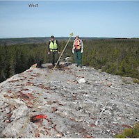
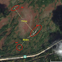
Mineralization on the Bridal Veil Property is concentrated in nine zones (see Map 2 for some of these locations) and is commonly associated with quart veins many of which are associated with fault structures.
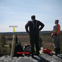
Silicified and mineralized host rocks are cut by a complex network of at least three generations of quartz veins. Chalcopyrite mineralization occurs both in silicified psammite and in two generations of crosscutting discrete quartz veins. Adjacent to many of these veins, sparse, green, and translucent sericite is abundant in remnant wallrock fragments floating in the quartz stockwork. Minor albite and Fechlorite also form sparse alteration phases and, with sericite, typically form curvilinear trails in a matrix of finegrained, recrystallized sutured quartz, and outline the main foliation in the altered host rock. The silicified rocks are cut, broadly parallel to the remnant foliation, by coarsegrained, mosaic and sutured, irregular quartz veins, which, both contain and have marginparallel, sinuous chalcopyrite blebs accompanied by chlorite‒sericite and goethite. Anomalous copper and other metals are found in singly veined and silicified host rock, in multiveined and silicified host rock and, in late, rectilinear crosscutting quartz veins. Samples with the most elevated metal concentrations are composed of silicified, multiple quartzveined psammite with chalcopyrite ± pyrite ± galena ± bismuth telluridebearing bands, lenses and septae and display sericite + Fe–chlorite + albite ± goethite alteration. An increase in the abundance of chalcopyrite appears to correlate with an increase in the proportion of pelite and semipelite lenses in the psammite, such as that at Abbotts Ridge. Thus, copper assay values at Abbotts Ridge are generally comparable to those at Bridal Veil, despite the lower intensity of silicification in the former. Semipelite layers and lenses in the host rock may have provided a more reactive, Fe–Sbearing setting for the reduction of the mineralizing fluids that accompanied emplacement of the quartz vein array. The youngest, rectilinear quartz veins are generally sulphidepoor, and contain <5% chalcopyrite + pyrite ± galena with minor sericite + albite + chlorite + goethite, particularly along their contacts with the altered host rock.
Quartz stockwork zones and tension vein arrays are common structural features (Buchanan, 2007) and are the result of a prolonged kinematic history (i.e related to movements of the earth’s plates). The subsequent faults along with specific stratigraphic horizons provided good sites for mineral deposition and the concentration of metals.
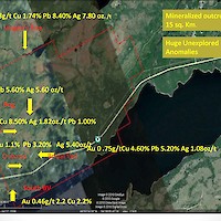
Recent grab sample from the mineralized zones have returned grades of up to 9.4% copper, 10.2% lead, 7.8 oz/ton silver, and 3.75 g/t gold. Grades have been found to be consistent over a number of outcrops. The main mineralization is chalcopyrite and galena.
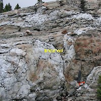
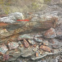
The Bridal Veil zone consists of disseminated and clots of chalcopyrite comprising up to 20% of the rock. Minor galena is also present.
Additional historic grades associated with specific mineral occurrences on the property sampled in 2010 are as follows:
Bridal Veil: 4.6% copper, 5.2% lead and 1.0 oz/t silver Abbott’s Ridge: 9.4% copper, 1.0% lead and 0.6 oz/t silver Hidden Outcrop: 4.95% copper, 3.2% lead and 5.4 oz/t silver Growler: 0.21% copper, 0.85% lead and 1.13 oz/t silver Meggan’s Rise: 1.74% copper, 8.4% lead and 7.8 oz/t silver First Burnt Pond: 0.93% copper, 10.2% lead and 5.7 oz/t silver Alteration is characterized by generally pervasive, moderate to intense silicification as well as more discrete silicic and/or composite quartz-veined zones (Jacobs, 2000).
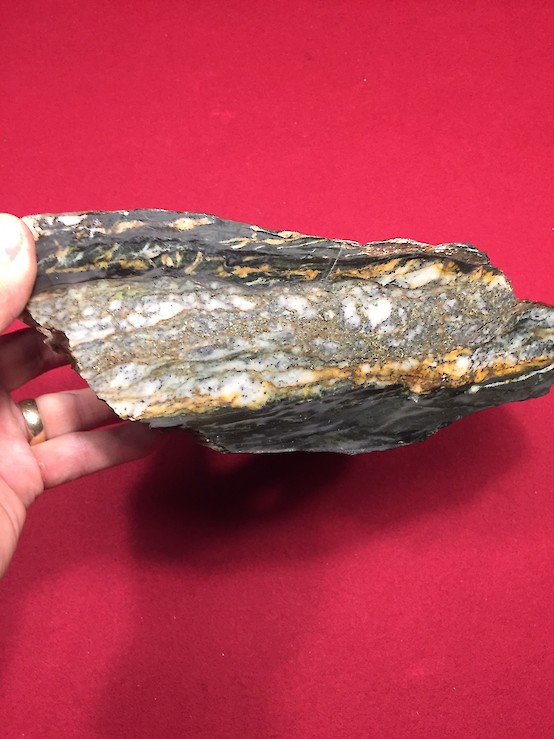
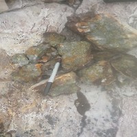
Plate 1: Sample taken from the Bridal Veil occurrence.
It is important to note that comments from a recent visit by a geologist to the site who examined the nature of the alteration and quartz stockwork zones combined with the recent identification of anomalous gold (i.e., 3.75 g/t) in sampling efforts, are considered to demonstrate the potential for gold mineralization along with possible significant amounts of copper, lead and silver.
An induced polarization geophysical survey was also covered over a small part of the southern portion of the property and has identified an anomalous area that is yet to be explained and warrants further exploration by prospecting, trenching and/or drilling. However, most of the property is yet to be examined using modern geophysical and/or geochemical techniques.
Mineralization Model
ORIGIN OF THE FLUIDS RESPONSIBLE FOR THE BRIDAL VEIL ZONE
The mineralization at Bridal Veil and Abbotts Ridge is polymetallic and, like many of the other examples of mineralization in the region, has metal associations somewhat atypical of orogenic gold systems. The copper-silver-lead-gold ± bismuth ± molybdenite ± tungstenbearing character of the Bridal Veil and Abbotts Ridge mineralized zones is very similar to metal associations observed in intrusionrelated, or Carlinstyle, of auriferous mineralization (Sillitoe and Thompson, 1998; Thompson et al., 1999; Cline et al., 2005; Hart, 2007; Muntean et al., 2011).
Such mineralized systems are typified by a diverse metal assemblage that includes many of the heavy, ‘deleterious metal’ suite such as arsenic (As), stibnite (Sb), cadmium (Cd), tellurium (Te), selenium (Se), and lead (Pb). For this reason, it may be important to note the abundance of highlevel (epizonal) and deeper, peraluminous to weakly peraluminous Devonian plutonic rocks in the region. These syn to post-tectonic granitoid intrusions may have acted as potential sources for metalcharged hydrothermal fluids that might then have become focused into discrete, silicarich mineralized zones.
Bridal Veil and Abbott’s Ridge are the two showings that have been most studied to date. The likely origin of these showings is that they are epigenetic orogenic vein systems hosted in north to northeast to west-southwest striking shear zones that are steeply dipping and are of Middle Devonian (382-392 million years) age. Hydrothermal events related to the emplacement of nearby plutons and possible sub-volcanic equivalents may also be responsible for zones of alteration and mineralization on the property as well as hydrothermal silicic breccia zones including sinters and quartz stockwork zones which occur throughout the Gander Group.
Orogenic gold deposits account for an estimated 75% of the gold extracted by humans. These deposits are typically formed at depths exceeding 4 kilometers in the earth’s crust, and are thought to have formed vertically along crustal faults at a wide range of pressures and temperatures ranging from sub-greenschist to granulite metamorphic facies (Groves et al, 1998, 2003) (also see Figures 1 and 2).
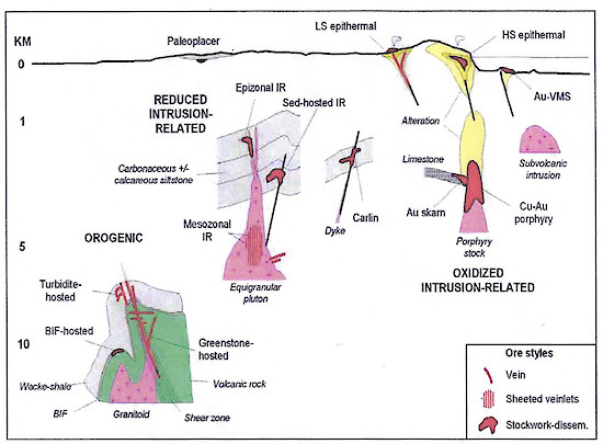
Figure 1: Schematic cross section showing the key geologic elements of the main gold systems and their crustal depths of emplacement. Note the logarithmic scale. Modified from Paulsen et al (2000) and Robert (2004a)
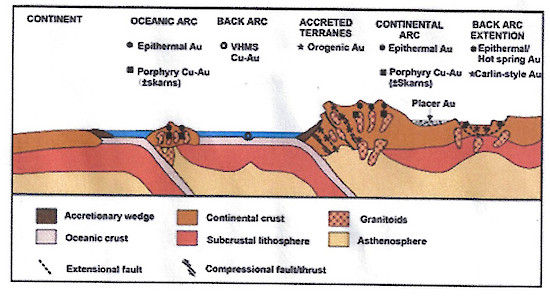
Figure 2: Cartoon depiction of settings for various types of gold deposits. Bridal Veil is thought to be associated with an orogenic setting in accreted terranes.
Other Information
Sandeman H.A.I. and Peddle, C. of the Mineral Deposits Section of the Department of Earth Sciences, Memorial University of Newfoundland have published a report in 2020 entitled “The Setting of Epigenetic, Structurally Controlled Polymetallic (Cu-Ag+/-Pb+/-Au+/-Zn) Mineralization at the Bridal Veil Zone (NTS 2D/15), Gander Lake Subzone, Newfoundland.” The report is attached for your reference.
-
Bridal Veil #1
- November 13, 2020
- January 13, 2021
December 8, 2020

