Blue Heaven Property
Property Location and Access
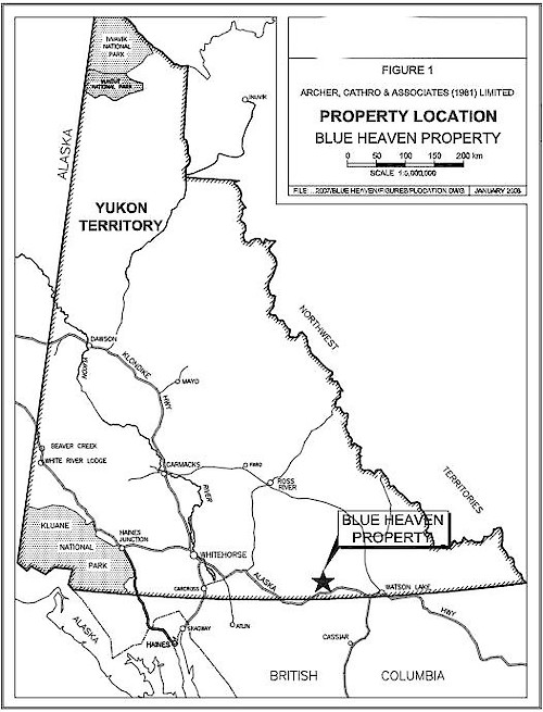
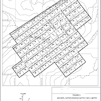
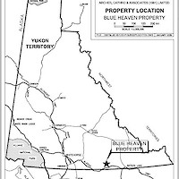
The Blue Heaven property consists of 121 contiguous mineral claims located in southern Yukon at latitude 60°19’ north and longitude 130°41’ west on NTS 105B/7 (Figure 1).
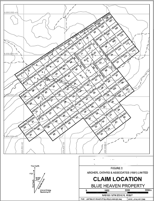
Access is provided by a 43 km road that extends from Km 1160 on the Alaska Highway to the Silver Hart camp site on the adjacent Silver Hart property (Figure 2). The road is suitable for two-wheel drive use. A system of four-wheel drive roads extends from the Silver Hart campsite onto the Blue Heaven property.
Whitehorse, the capital and largest community in Yukon, is located 355 km by road west of the property while Watson Lake, where most exploration services are also available, lies 180 km to the east. Whitehorse receives daily scheduled air service from Vancouver. The closest all-season deep- water seaport is at Skagway, Alaska 430 km by road to the west-southwest. The nearest railhead is at Fort Nelson, B.C., 720 km to the east-southeast.
Physiography and Climate
The property is situated in the Cassiar Mountains. Local elevations range from 1050 m on Oake Creek to 1600 m on a ridge crest along the southern edge of the claim block. Creeks draining the property flow into the Meister River, a tributary of the Liard River.
Vegetation includes thick stands of mature balsam, spruce and pine interspersed with willow below 1300 m giving way to buckbrush and stunted balsam and finally grasses and lichen above 1500 m. Linear vegetation-depleted zones up to 15 m wide and 100 m long are developed along the surface trace of some known and suspected mineral occurrences. Bedrock is generally obscured by talus above 1400 m or by glacial till at lower elevations.
Climate in the area is categorized as continental and is characterized by relatively long cold winters and warm dry summers. Daylight ranges from a minimum of about 6 hours per day in December to a maximum of 22 hours per day in June. Annual precipitation averages approximately 450 mm. Snow can occur in any month and normally covers the ground from October to May. Maximum snow depth is about 150 cm. Permafrost is common in the area but is not pervasive. The local streams usually break up in late May and freeze over in early November.
Regional Geology
Geology of the Rancheria District was mapped at 1:250,000 scale in the late 1950s, 1960s and 1970s by the Geological Survey of Canada (Poole, et al., 1960; and Gabrielse, 1969 and Tempelman-Kluit, et al., 1976). Various parts of the area have been remapped at 1:50,000 scale by geologists working for Indian and Northern Affairs Canada (Lowey and Lowey, 1986; and Amuken and Lowey, 1987), B.C. Ministry of Energy and Mines (Nelson and Bradford, 1986 and 1993), and the Yukon Geological Survey (Roots, et al., 2004).
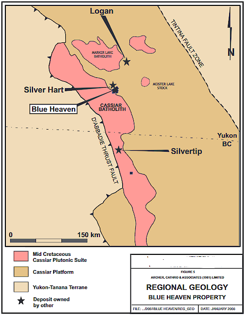
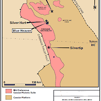
The Rancheria District is largely underlain by calcareous and non-calcareous sedimentary and metasedimentary rocks belonging to the Cassiar Platform tectonic element (Figure 3). The belt of rocks extends through northern British Columbia into central Yukon. The northeastern edge of the belt is defined by the Tintina Fault Zone, a series of subparallel transcurrent faults that produced about 420 km to 460 km of dextral offset in the Early Tertiary times (Mortensen, et al., 2000). The southwest side is bound by the D’ Abbadie Thrust fault (Keijzer, et al., 1999). Cassiar Platform rocks were mainly deposited as shallow water sediments during Paleozoic times along the margin of North America. They were deformed and metamorphosed by arc-continent collision in the early Mesozoic and were subsequently intruded by various intrusive suites. The regional metamorphic fabric strikes southeasterly and dips moderately toward the northeast.
Intrusions in the area range from Early Jurassic to Early Tertiary in age (Mihalynuk and Heaman, 2002) but most belong to the Mid-Cretaceous Cassiar Plutonic Suite (Mortensen, et al., 2000). The Cassiar Plutonic Suite intrusions include batholiths (Cassiar, Hake and Seagull), stocks and dyke complexes.
The major high angle faults in the area are aligned subparallel to each other and exhibit primarily dextral strike-slip offsets. Movement on these structures produced a series of smaller, northeast trending extensional faults that are associated with silver bearing mineralization at a number of prospects in the area.
Regional Mineralization
The Cassiar Platform and intrusive rocks of the Rancheria area are host to numerous mineral occurrences including: silver-lead-zinc±copper±gold veins, tin-tungsten-zinc skarns and lead-zinc silver replacement bodies. The most significant discoveries in this region to date are the Silvertip (Midway), Logan and Silver Hart Deposits. The Silvertip Deposit is classified as a manto replacement body hosted in Devonian sediments. Diamond drilling and underground development have outlined a mineral resource containing 2,570,000 tonnes with an average grade of 325.0 g/t silver, 6.4% lead, 8.8% zinc (Silver Standard Resources, 2006). Vein and shear hosted mineralization occurs within the Cretaceous Marker Lake Batholith at the Logan Deposit where historical resources are estimated at 13.08 million tonnes grading 5.1% zinc and 23.7 g/t silver (Traynor, 2005).
Property Geology
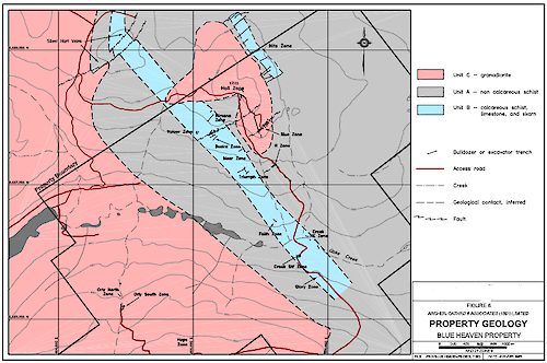
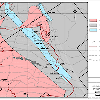
Bedrock exposure on the property is poor (<5%) and is generally restricted to creek cuts, outcrops above tree line or small windows through the glacial till. The main units are Lower Cambrian schist, limestone and skarn belonging to the Cassiar Platform and granitic rocks of the Mid-Cretaceous Cassiar Batholith. Mineralized quartz veins crosscut both the metasedimentary and plutonic rocks but are in turn crosscut by younger felsic and mafic dykes. Property geology is shown in Figure 4.
Mineralization at Blue Heaven
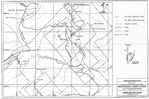
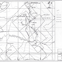
Exploration programs up to and including 2002 have identified three types of mineralization within 36 occurrences on the Blue Heaven property (see historical compilation Figure 5).
- High grade silver-lead-zinc veins: Twenty-four of the occurrences consist of galena and sphalerite with varying amounts of pyrite, arsenopyrite, tetrahedrite and chalcopyrite hosted in northeast trending quartz veins. These veins crosscut both intrusive and metasedimentary rocks. The best veins exposed are in the Blue and H Zones which returned assays up to 12,396 g/t silver over 20 cm and 10,561g/t silver over 94 cm, respectively.
- Carbonate replacement: The second type of mineralization consists of galena and sphalerite found in eight strongly oxidized, manganiferous siderite and jasperoid replacement zones developed within the southeast trending belt of carbonate metasedimentary rocks. Chip samples from a 1998 excavator trench in one of these areas (Desire Zone) returned a weighted average of 5.0% lead, 3.6% zinc and 65.6 g/t silver over a width of35.8 m (Becker, 1999).
- Skarns: The last type of mineralization consists of five tungsten±copper skarn showings, four of which lay within the same belt of carbonate metasedimentary rocks that hosts the lead-zinc-silver replacement mineralization. A chip sample of garnet-diopside skarn containing pyrite, pyrrhotite, chalcopyrite and scheelite returned 0.3% W03 and 0.31% copper over 3.5 meters in a 1998 excavator trench at the Moar Zone.
Bulk Sample Test
Exploration on the property in 1999 evaluated the Blue and H Zones. At that time, both zones were noted to contain northeast trending high grade silver-lead-zinc veins. Work included excavator trenching, bulk sampling and reclamation. During the excavator trenching program, galena and tetrahedrite rich mineralization was separated from lower grade material to form a bulk sample.
The mineralization was placed in fibreglass bags and sent to a smelter. The net weight of the material was 52.31 tonnes of which 51.47 tonnes were dried ore and 0.84 tonnes (1.6%) moisture. The grade of the shipment was 8563 g/t silver, 56.2% lead, 9.5% zinc and 1.2 g/t gold.
In 2002, a short program of hand trenching and power auger drilling was done to test select vein and skarn targets (Wengzynowski, 2003). Due to budgetary constraints the auger samples were not analyzed and since then the property has been dormant.

